ABOUT MATANUSKA GLACIER
The Matanuska Glacier is located in a zone of the continent that has a perfect blend of circumstances for the creation and support of glaciers, many glaciers in fact.
Alaska contains more than 100,000 glaciers of various sizes and importance in the ecosystem. Only 616 are officially named. Matanuska Glacier in our backyard, the foundation for your glacier hiking tour, is one such glacier.
It is a prominent, bold, contrasting, and magnificent feature of the landscape that has been appreciated for thousands of years by the region’s original inhabitants and the locals and tourists of present-day Alaska.
The influential conditions here that created and continue to support Matanuska Glacier are the following:
- Proximity to a Large Moisture Source: Matanuska Glacier is located near the Pacific Ocean (Gulf of Alaska), and moist ocean air makes its way inland where, under the right circumstances, it will freeze and fall as snow.
- Elevation: Due to rising bedrock of the Talkeetna and Chugach mountain ranges (both can be seen while taking your glacier tour), moist air from the ocean is forced into higher, colder air. The moisture subsequently freezes and falls as snow, accumulating layer upon layer where, beyond 7000 feet of elevation, there are few risks of the snow ever fully melting.
- Latitude: Matanuska Glacier is located at 61.6° North Latitude, much farther away from the equator than most any location you might visit within North America. Thus, the winters here are longer and average temperatures cooler throughout the year. This further allows snow at high elevations to accumulate and compress into beautiful, blue glacier ice.
Source: National Park Service: Common Questions and Myths About Glaciers
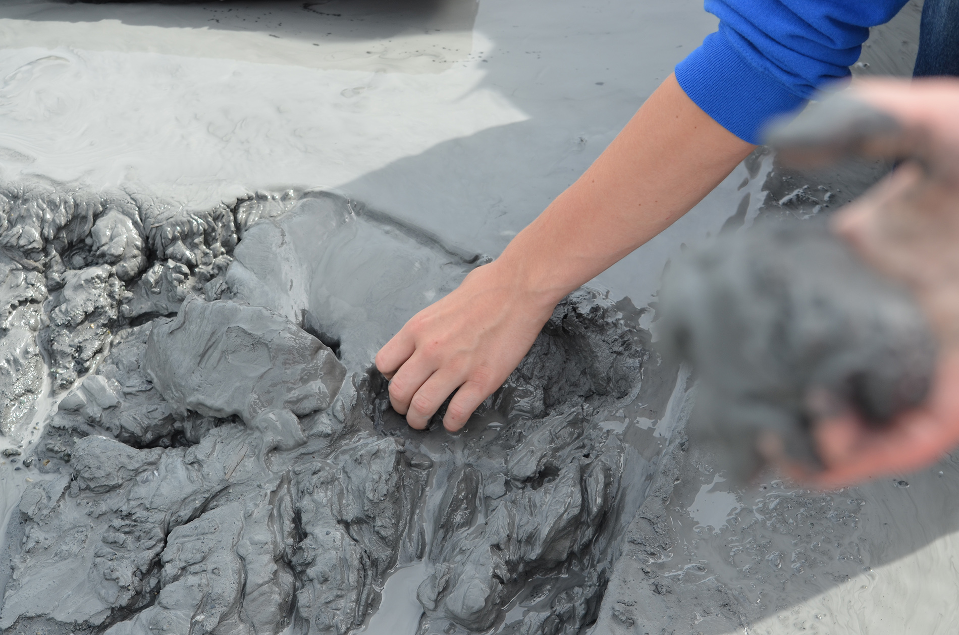
Kids discover fine, sticky, glacial silt mud at Alaska's Matanuska Glacier.
The Matanuska Glacier is a large ice flow, 27 miles long and 4 miles wide at the terminus, averaging approximately 2 miles in width.
This glacier is a valley glacier; it exists on a valley floor. The majority of glaciers in Alaska today are smaller alpine glaciers that hang off mountain slopes.
The Matanuska is an active glacier that flows at one foot per day in the summertime. It takes approximately 600 years for the ice to form up-glacier and advance to the terminus.
The ice of an active glacier always moves forward due to gravity; like water in a river, the ice will flow down the valley. When ice melts at a higher rate than snow accumulates, the glacier terminus 'recedes'. (The term 'receding' does not refer to the ice actually traveling back up the valley.)
A frequently asked question concerns the cause of the blue ice. The density of glacier ice allows the entire spectrum of light to be absorbed with the exception of the blue light which is refracted and can, therefore, be seen by your eye.
Glacier Terminology:
Moraine: Moraines are landforms comprised of glacial till (poorly sorted, an unstructured deposit composed of boulders, clay, gravel, sand, and silt), deposited by the glacier during flow, creating a ridge-like feature in the landscape.
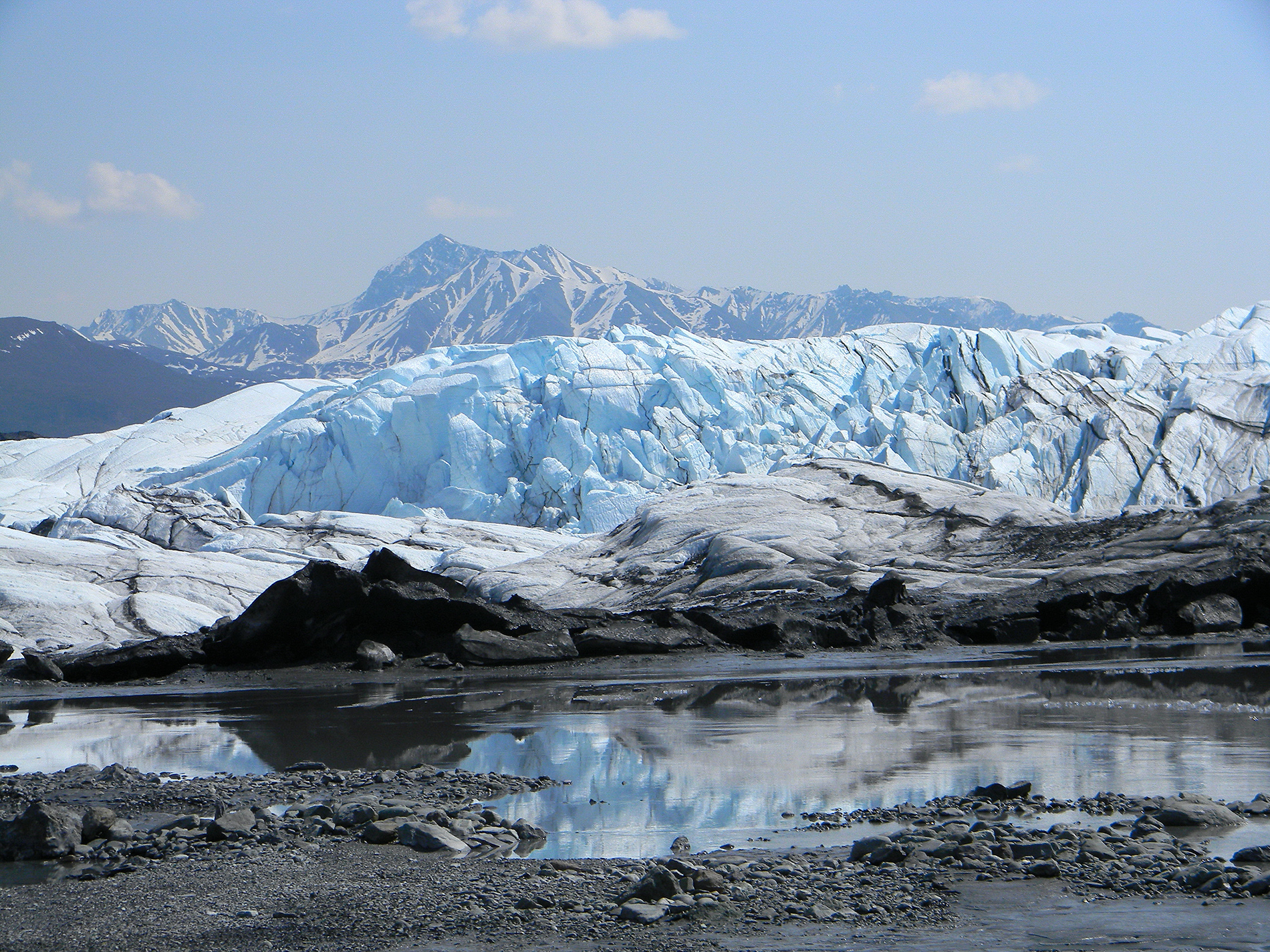
The Matanuska Glacier is a large ice flow, 27 miles long and 4 miles wide at the terminus, averaging approximately 2 miles in width.
Lateral Moraine: Lining both sides of the glacier, lateral moraines run parallel to ice flow. Lateral moraines are generally created by two processes:
1) a build-up of debris between the sides of the glacier and the bases of surrounding mountains from rock slides off the mountain
slopes and
2) the dumping of rocks and other debris off the sides of the ice.
Medial Moraine: Created as two ice streams merge. As the glaciers melt, a pile of debris is pushed up in between them. The medial moraine may be recognized as a 'ribbon' of black material running down the center of the glacier.
End or Recessional Moraine: The terminus (or end) of the glacier is marked by this moraine. Generally lying perpendicular to ice flow, the
end moraine is created as the ice melts and deposits rock and debris.
Vent: An opening in the ice through which water exits the glacier, draining the sub-glacial and en-glacial conduits (nearly lateral ice channel formed by flowing water).
Basal Ice: The debris-rich ice layer at the bottom of the glacier. This ice is easily visible in several places at the terminus. Most sediment comprising the moraines is first transported in the basal ice.
Moulin: A wide vertical shaft connecting the ice surface to the glacial conduit system. Moulins are created by meltwater and can be hundreds of feet deep.
Crevasse: Deep glacial fractures formed by ice flow especially in areas of friction, rapid flow, and underlying topography.
Serac: Large, towering blocks of ice. Also created by the differential speed in the ice movement.
![]()